

Hello, everyone, thank you for having me.
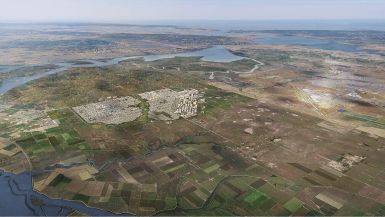
I am presenting on one new town that we’re working on, where I’m the head of planning. A new town that, if we are allowed permission to build it, will be about 45 minutes to an hour from San Francisco, between San Francisco and Sacramento.
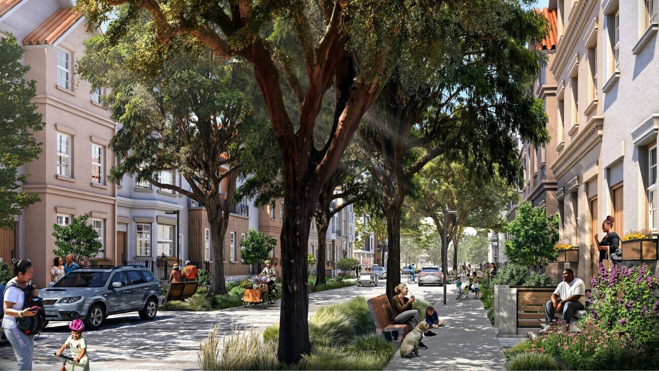
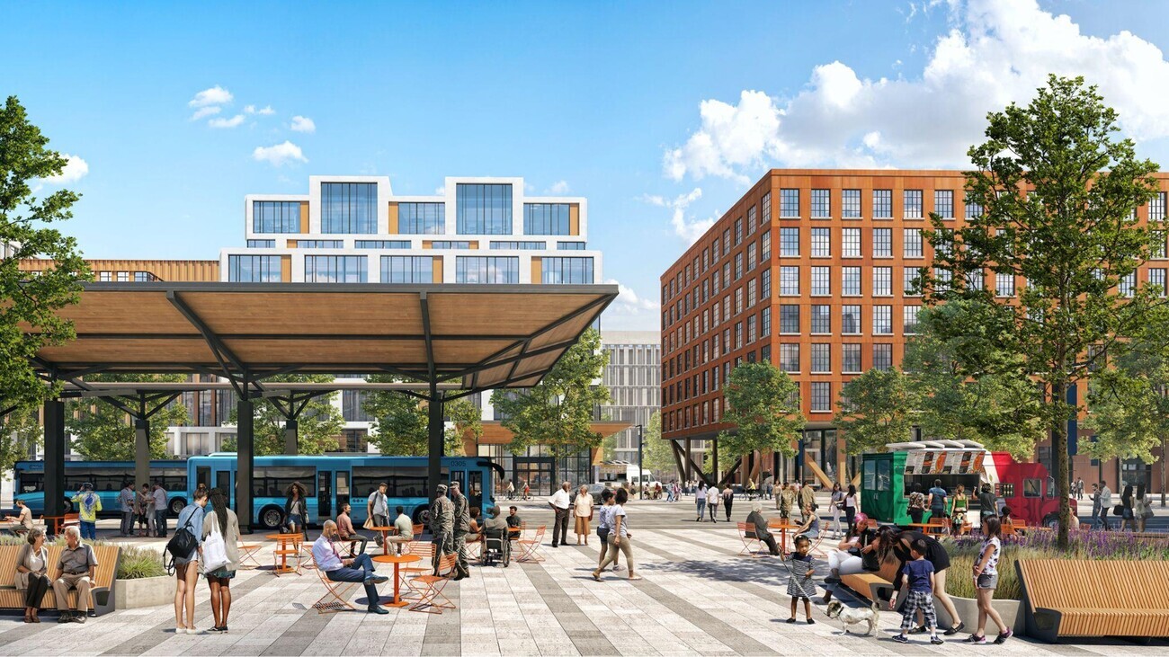
When I talk about this, I find most people expect a beautiful cosmologic form, like Brasilia or perhaps even better, Wakanda, and when they find that our renderings are just this (above figure 1 & 2), they’re somewhat disappointed. They say: “That’s not futuristic! That looks like just a normal city!” And to that, I say, yes, we are working on a proposal for a classic American city.
As you may all know, just as Patrick described about the UK, California has a terrible housing shortage and has for many years.
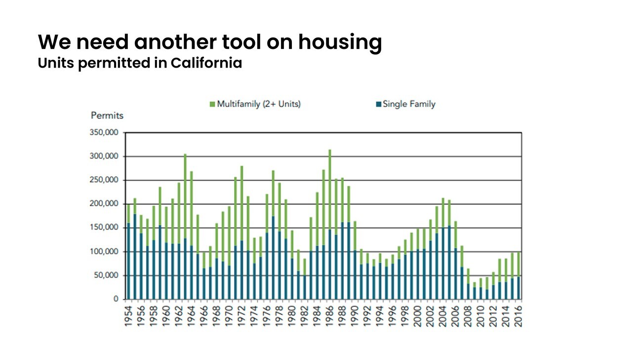
When we look at housing production, going back to the 1950s, the production per person has fallen off precipitously (above figure 3). That is the backdrop. I view new towns as necessary because of this. You can imagine a society that perhaps handled its housing production differently, but ours has failed.
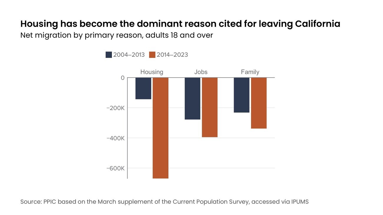
Housing has become the dominant reason people are leaving California (above figure 4). The “sunbelt” states in America (like Texas and Arizona) are the ones that are growing. California, in spite of all of the economic opportunities, is losing population.
The truth is that we don’t just have a shortage of housing units. And I think this is a mistake for housing advocates to get a little caught up in the math of unit production. We specifically have a shortage of walkable urban neighborhoods because we have not added walkable urban fabric in this entire country for a hundred years, since the 1920s. And as a result, it’s like we are left with this inheritance from the past, like people in the Middle Ages marveling at the monuments, like how did they create these walkable neighborhoods? And the only way we believe to solve this problem is to rediscover the lost art of building urban neighborhoods.
We are proposing a new town with room for 400,000 residents, assuming 2.3 people per household, that’s 174,000 new homes, an equivalent amount of jobs, and then, of course, parks, schools, shops and hotels, and all the things that go into a complete community.
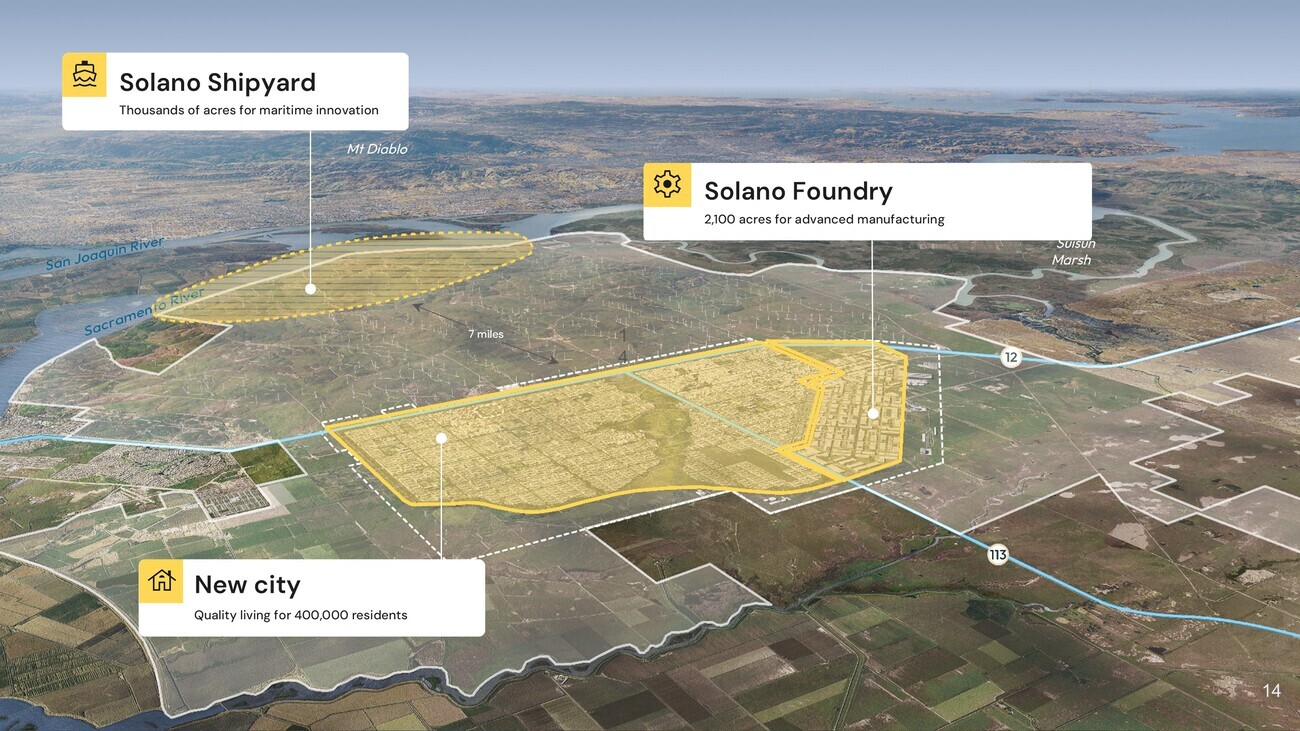
We own 69,000 acres, half way between Sacramento and San Francisco. The primary project is the new city, but there are other related projects. We’re working on a shipyard on land we own on the Sacramento River, and a lot of solar generation on the land holdings as well.
The starting place for the city plan is a very classic American approach. After Thomas Jefferson bought Louisiana from you guys, we divided up the country into a grid. That grid was further subdivided, and when you go to places that are on the Jeffersonian grid, like the city of Chicago, the dimensions of the Chicago blocks are exactly the dimensions for the city plan you are looking at here. The block dimensions are based on the lines from the Homestead Act in the 1800s that are carried through into the agricultural roads in the entire Midwest and west of the country.
So this block pattern, these block dimensions would be very familiar to any of you who have been to an American city. There’s typically a long side and a short side of the block. Typically you put apartment buildings on the short side. Sometimes there’s an alley in the middle. Chicago has alleys. New York and San Francisco do not. Our basic block prototype has alleys.
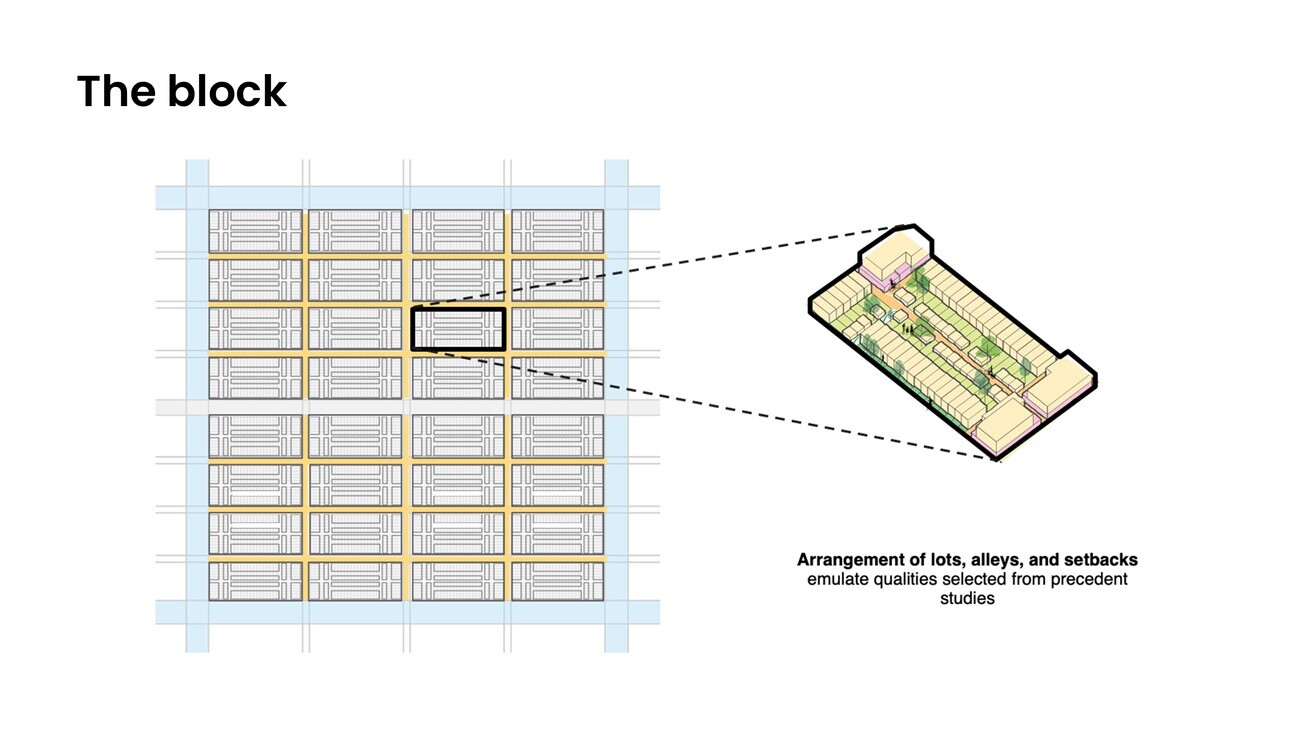
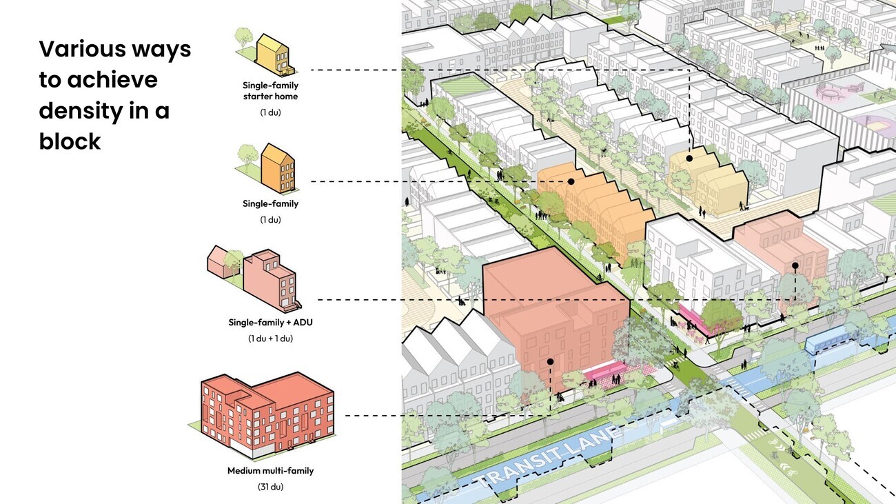
We’ve done a lot of work on building typologies (above figure 6 & 7). We’re not reinventing architecture. We are trying to follow the principles of urbanism that have created some of the great world cities. These are some of the block studies. The template for this, of course, is the 1811 grid for Manhattan. And this is the most influential city plan in America. It set the template that was copied and emulated in thousands of other cities. The 1811 version is, of course, missing a big park in the middle. It’s missing the modernist interventions where here and there they broke the grid to build public housing projects. But essentially this street grid has remained unchanged for 200 years. And you just think about the incredible cultural and economic upheavals that have happened in those 200 years that did not require a change to the street grid. It’s a framework for growth that is very flexible.
That’s our model. It happens to be the same approach taken to the O’Farrell plan for San Francisco, as well as small towns that are very close to where we’re trying to do this. So it’s a very familiar approach.
Another example of the 19th urban century extensions is the Back Bay in Boston. This row house fabric is seen in cities all over the world. They are today some of the most beloved neighborhoods. They’ve held their value for centuries. One of the first thing we did when we were starting the planning for this project is we did a survey of row house neighborhoods around the world. We measured them, and tried to understand physically what the core attributes are to come up with this plan.
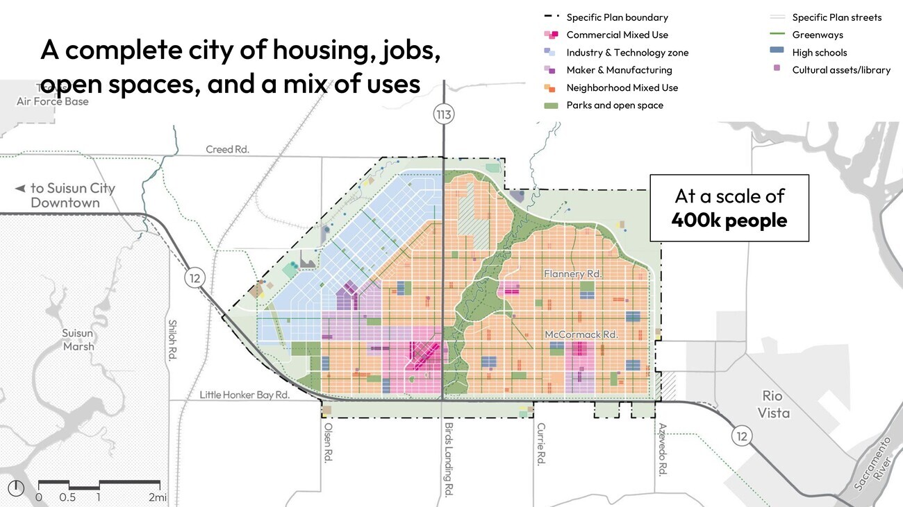
So, putting it all together, this is the zoning map from the plan we are seeking permission to build (above figure 8).
The pink is downtown. The orange: we don’t call it residential, we call it “neighborhood mixed use.” We’re doing our very best to not have single use zoning. Every zone is mixed, but they have different characters. The blue, the diagonal is the industry and technology zone, which we’re putting a lot of energy into.
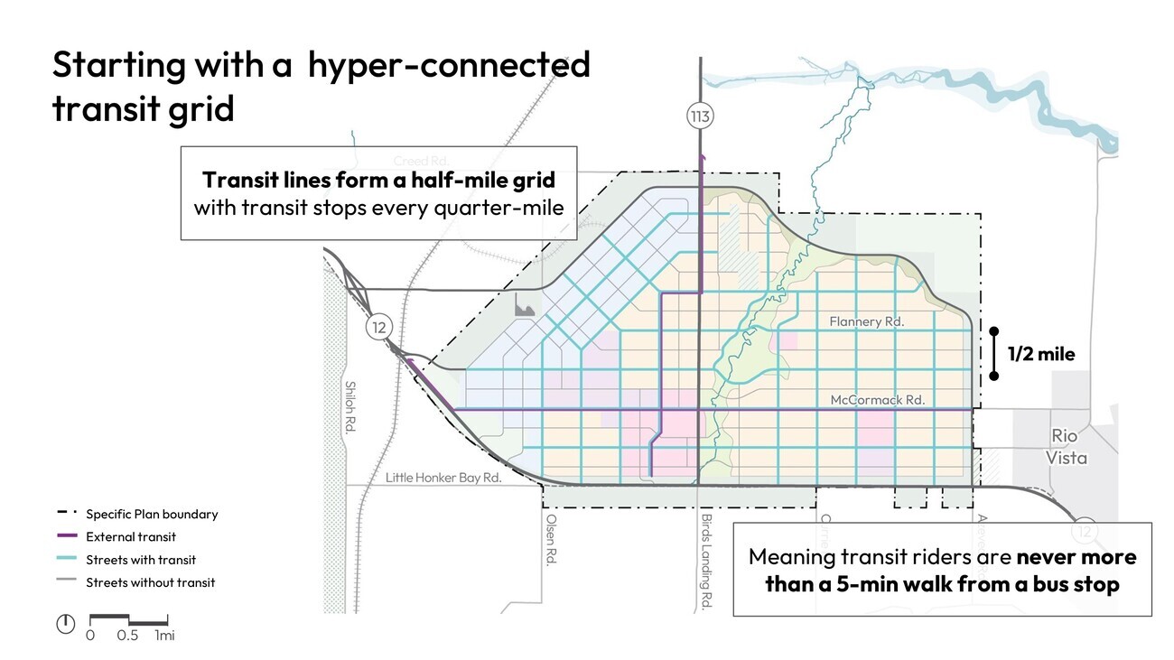
There is a grid of bus rapid transit lines on a half mile grid (above figure 9). So, big decision, not a radial transit system, but a grid network.
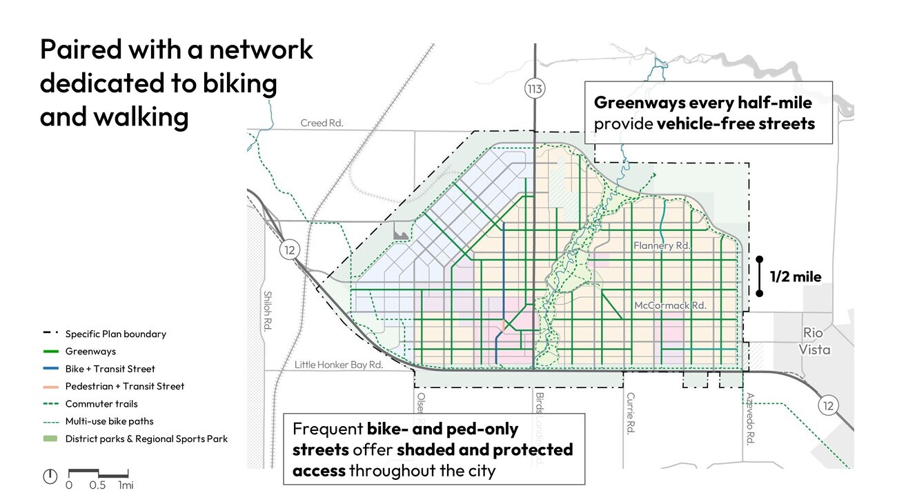
There is a network of “greenways”, which are car-free streets (above figure 10); a freight rail spurs we’re working on building to the main Union Pacific freight line (above right).
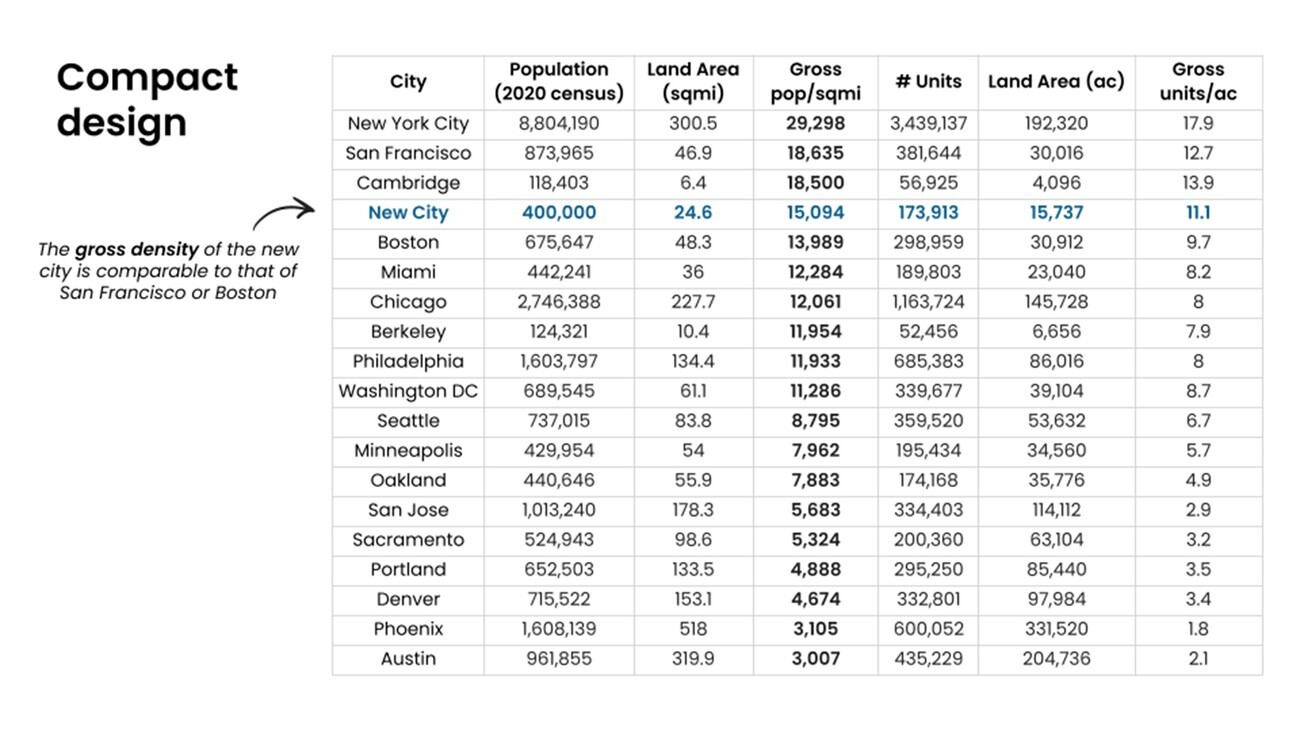
The gross residential density comes in a bit between Boston and San Francisco, with similar fabrics (above figure 11).
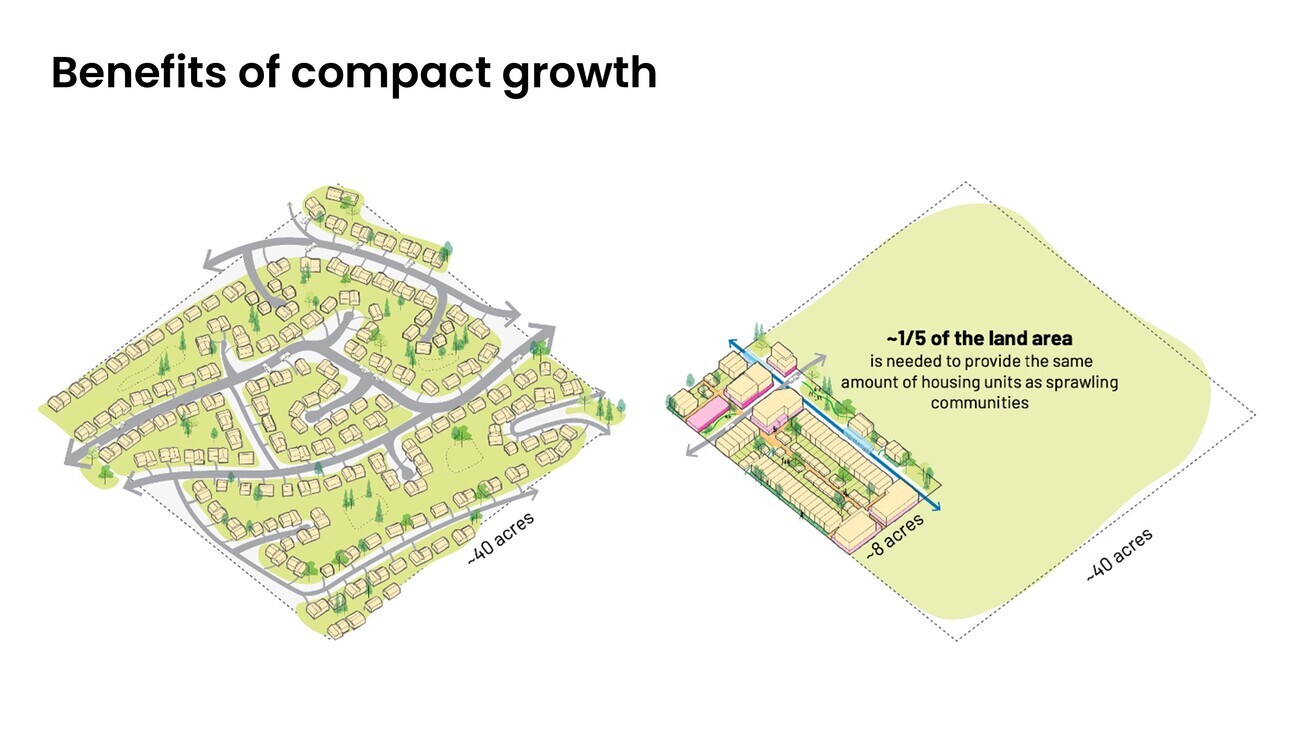
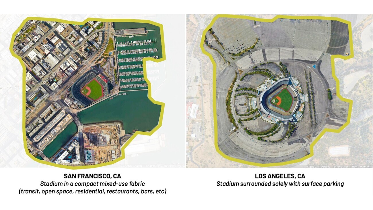
I spent a lot of time doing these diagrams within the community and just explaining planning 101 about compact growth (above figure 12) – how if you surround your stadium with uses, you get so much more out of it if you don’t need parking (above figure 13).
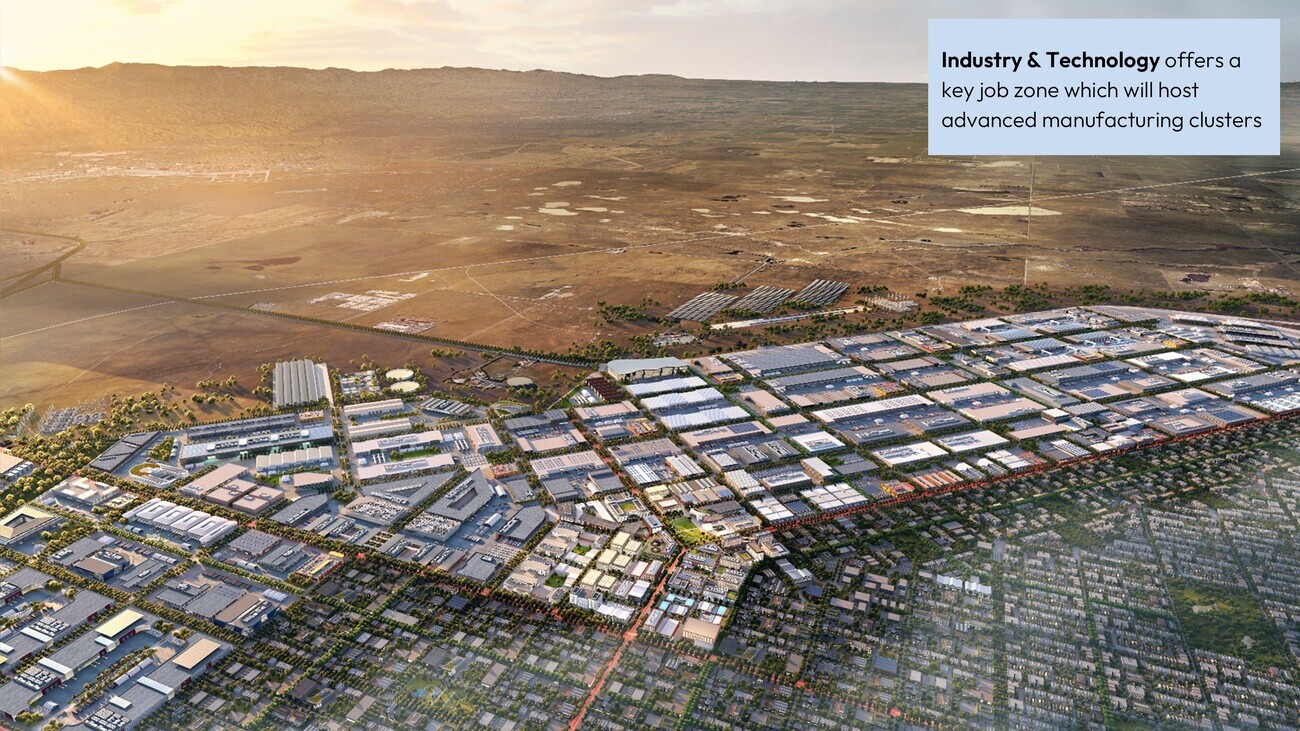
But a lot of our discussion turns out that it’s about jobs. We have a major effort on essentially an expansion zone for Silicon Valley to make things in the real world. The brand name of the industry and technology zone is Solano Foundry (above figure 14). It’s going to be a really incredible opportunity.
Workers can live in the city and commute by transit or by bike. But this is going to be, we hope, a major manufacturing center. So this ends up being where a lot of the time goes. So it’s not just housing, it’s the jobs too.
So summing it up, I think the insight that the new urbanists and many others have had is that most development is greenfield, so why don’t we try to do a better job with the greenfield? We see ourselves in that tradition.
Thank you very much.
Réutilisation
Citation
@inproceedings{metcalf2025,
  author = {Metcalf, Gabriel},
  publisher = {Sciences Po Rennes \& Villes Vivantes},
  title = {California Forever : entre San Francisco et Sacramento, une
    ville nouvelle comme réponse au désastre du logement en
    Californie\,?},
  date = {2025-09-18},
  url = {https://papers.organiccities.co/california-forever-entre-san-francisco-et-sacramento-une-ville-nouvelle-comme-reponse-au-desastre-du-logement-en-californie.html},
  langid = {fr}
}